360 degree location w/ +/- 2 degree uncertainty reduction algorithm?

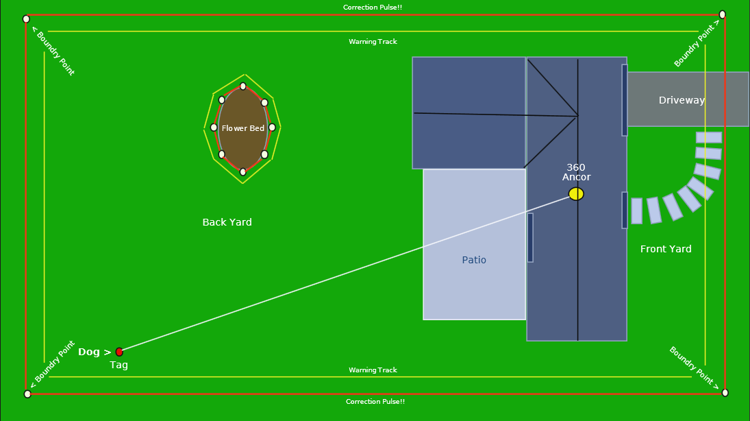
Hello Qorvo community! : ) In re: QM35825 Dev Kit (in a one anchor paradigm only!)

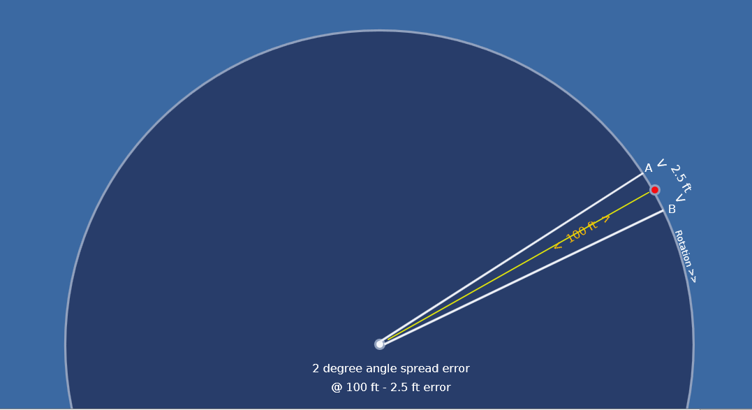
Early thoughts to reduce the inherent "+/- 2 degree uncertainty band (A to B) in the tag’s (red dot) location (see pic).

In a 100ft distance from the anchor (white dot) to the tag … distance is accurate to within +/- 4 inches (perfect for my application!).

… but the “left to right” angular position (A to B) could be anywhere within the uncertainty band of +/- 2.5 feet! : (

Please note: I’m day one with UWB (I don’t even have my evaluation kit as of yet!) : )

My early laymen’s assumptions and thoughts:

In an apparent circular scanning paradigm (UWB phased array) I can locate the tag, but with a +/- 2.5 foot uncertainty of its angular “left or right” (A to B) position.

My thoughts : (Hypothetical with some easy “plug in” numbers)

Lets say the UWB phased array scans this entire 360 circumference in one second.
When it finds a “tag” … I stop this scan dead immediately. The tag has been found in this particular 2 degree angular scan segment , but without an exact angular point! (it could really be anywhere within this uncertainty band).

At this point, I instruct the normal 360 scan rate clock to increase by 100 times! … this accelerated scan rate goes from, lets say, 4 clock cycles residing within this “A to B” segment span … to 100 clock cycles within this same “A to B” distance.

My algorithm then simply counts the clock cycles until the tag no longer presents itself in this fast scan.
ie:
1 clock cycle = tag is located at “A”
thru
50 clock cycles = tag is located at the “center” of this uncertainty band
thru
99 clock cycles = tag is located at “B”

The algorithm would then output the tags true angular position +/- 4 inches!

Basically,
Scan (search) 360 degrees at normal clock speed, stop scan when it detects a tag, Fast scan just this fixed uncertainty area +/- , counting the fast scan clocks until tag stops responding to the scan inquiries.

… thoughts on this?

Thank-you!

… this maybe a much simpler way:

With an un-modified standard fixed 360 scan speed, simply count the number of consecutive tag responses/per scan steps … then divide by two! … to output the tags true angular position.

You are making the assumption that the uncertainty is uniformly distributed and uncorrelated. In effect treating it as a resolution.

If it was a resolution limit then your idea would work well.

If it was purely random noise then averaging lots of samples would also work well.

Unfortunatly it’s more of a systematic error that will give a bias to the output that will depend on a lot of different factors.

So yes, your idea will probably help improve accuracy. How much advantage it has over a simple average of multiple measurments is hard to be sure. It’s not going to eliminate the errors only reduce them a little and you’ll probably still have a bias in the results.

Headings are good for approximate locations and as a verification that data is self consistent. But if you want to get accurate locations you generally need to use ranges rather than headings.

Having said all of that I’ve not played with the heading measurment much, this is mostly based on my general feel for how these systems work. I could be completely wrong :slight_smile:

Thanks Andy!

Since I really need the location error at 4" maximum in all directions, I’ll do as you suggested by using two anchors for direct measurements out to the tag.
… and only using the heading info to determine if my tag is to the anchors left or right side of them.

That is probably a better solution. It also allows you to have a sense of confidence in the results. Two headings should give you an approximate location. Two ranges should give you a location.
Each heading/range pair should give you a location. That’s in theory 4 different ways to calculate the location. If they all agree (within a margin of error) then you can be fairly confident that you’ve got good data. If they completely disagree then you know your result is unreliable.

Looking at your diagram two thoughts come to mind - Firstly I’m assuming the dog would be close to ground level and the anchors would be on the roof. That means that there will be some areas close to the house where the line of sight from tag to anchors will be blocked by the roof. Since you probably don’t mind the dog being near the house this isn’t an issue directly but you may need to detect this condition to prevent false alarms. If the direct path is blocked you can measure a refection path which is far longer. So if you get high confidence points that the dog is near the house followed by low confidence points a long way away then they are probably in the shadow of the house.

Secondly make sure you angle the antennas correctly so that you don’t risk hitting 180 degree ambiguities on both the angular calculation and the distance calculation simultaniously.

Understood! …Thanks!
In most cases, the property line between the adjoining homes have a “real” fence between them.
If so, I would mask out the detection line along the real fence anyway.
Thanks again for your good advice!

A 4 anchor set-up may be the best way to go with a guaranteed minimum of two “line of site” anchors.
Distance measurements to use only the two shortest reported anchors.